Travelling: Faroes


Map of the Faroes
The Faroes

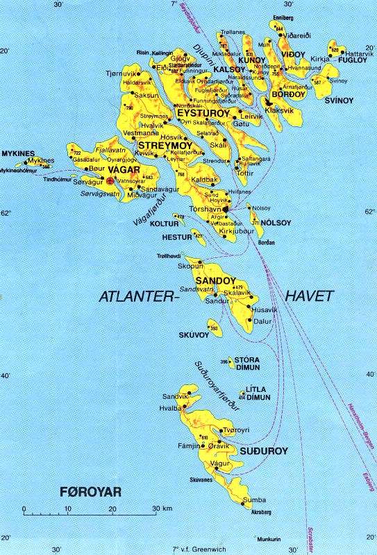
Once more the map of the islands. Tórshavn is situated at 62°N and almost at 7°W. That's about 120 NM northerly than Lerwick at the Shetlands and 240 NM to the south of the polar circle. No need to feel yourself cold because that. The average temperatures are almost the same like those at the Shetlands. It's raining much more, about 1500 mm a year. Thus you'll find many streams and little waterfalls. The islands lay in the 'Gulf stream' and are relatively warm. It's hardly freezing there and if so, it will not last for long time. The weather is very changeable. what you will meet here in one week, you'll see there in one day only.
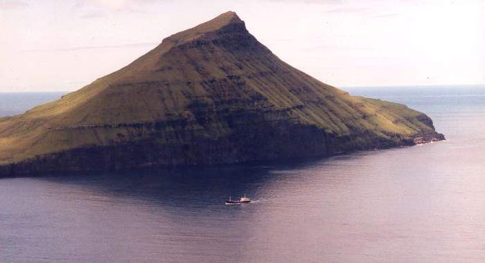
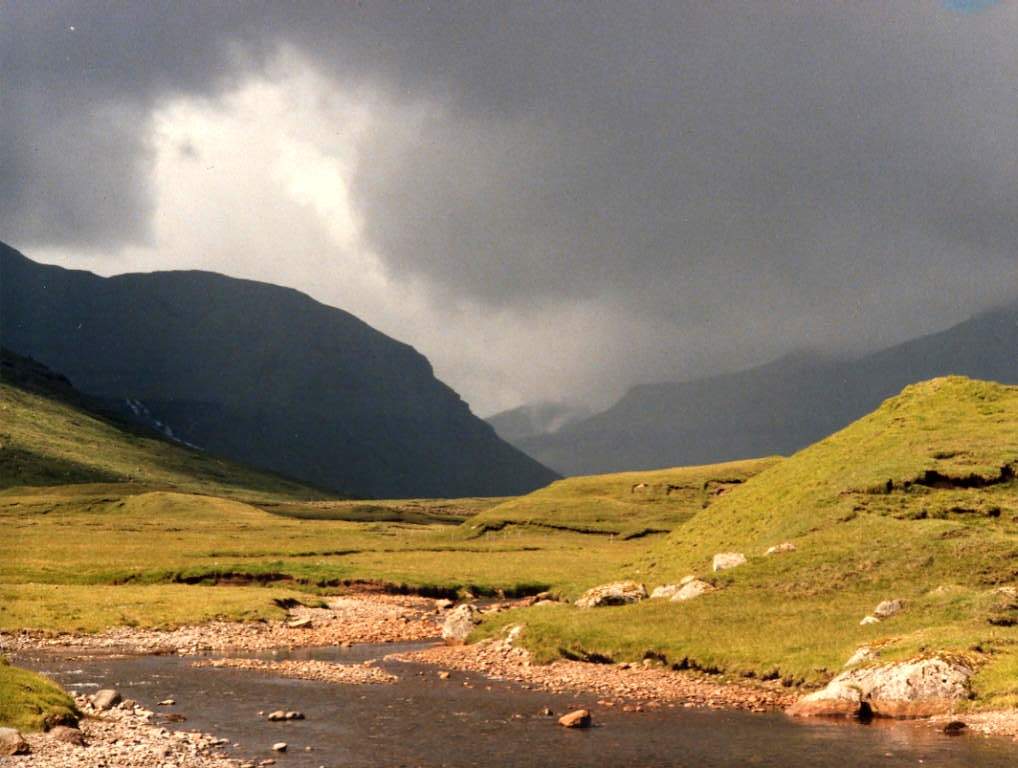
We always will use the first day after our arrival to take rest and to see where we are. We then look what possibilities there are. There are bus lines to most places - and dependent on the weather; ferries. We decide to rent a car and to explore the islands on our behalf. Main occupation is fishery. the ships are very big and real factories. Then there are many sheep. these animals have the absolute right of the way; if you kill one by car accident, it can become very expensive. Not only the dead animal you'll have to pay for, but also for its eventual descendants!... Nature is very rough and exciting with splendid wide views, if the weather is clear of course. It is very good possible to climb the mountains, but you should bear a stick with you to see if the bottom is reliable or not... Also you should take a compass with you; due to sudden fog the visibility can reduce to zero in no time! Then you'll loose all orientation. If you accidentally slip away it cause your disappearing into the ocean... The northwestern part of the islands is the highest and the Slaettaratindur on Eysturoy is the highest summit with 882 m. Mostly the summit sits in the clouds. The amount of rain depends on the place where you are. The high northwestern part has most rain and the lower eastern part is the driest. The tidal currents are extremely strong and can reach a speed of 12 knots! You have to navigate very careful. But there is not much rising of the tide; in Tórshavn approximately 20 cm, in Klaksvik about 40 at maximum. It is not an area for daredevils...


Kaldbaksfjørður
Kaldbaksfjørður Coes and wool
Gentle, very gentle goose
Very gentle goose
Sheep wool
The fleece


Hestur and Sandoy
 The isles of Hestur (right) and Sandoy appear from under their cloudy sheet.


Koltur Norðradalur
Syðradalur


The Kings' Farmhouse Kirkjubøur
  Kirkjubøur, opposite the isle of Hestur. Once an Irish bishop   decided to build a cathedral, then the money had gone!
Kirkjubøur; 'The Kings' Farmhouse', shed and door with forged iron hardware.
Shed
Shed - door Door of the Kings' Farmhouse Cathedral-ruins
If you ever read the book of Timothy Severin about the Brendan-expedition you also read the name of 'Trondur Patursson'. This artist lives here. Kirkjubøur has an old name; Brandarsvik. There is a legend, though probably a real history that we don't understand quite well, about an Irish munch, St. Brendan, who sailed from Ireland, through the Faroes to Labrador. Anyway, it seems to be quite sure that, long before the Vikings landed in the Faroes, the Irish had already lived here. That's why an Irish bishop liked to build a cathedral in Kirkjubøur. However the poor inhabitants of the islands weren't able to raise the funds and thus the church remained unfinished. A British scholar, Timothy Severin, thought the story of St. Brendan to be more true as others would think it was. Therefore he built an authentic replica and sailed with it from Ireland through Faroes and Iceland to northern America. He and his crew sailed in two stages with a wintering on Iceland. After a difficult and dangerous trip around Mykines and Vágar they passed Tjørnuvik and finally they reached Tórshavn. In a local radio program they told that they should be very happy if somebody from the islands would accompany them on their voyage. Trondur applied for the job and this very capable and close to the nature living seaman proved to be the best choice they made! - Right; detail of a sculpture in the wall near the main entrance of the ruins. Fresco in the wall of the cathedral


Funningur on Eysturoy Saksunardalur with the stream Stórá
 Rain shower over Saksunardalur
  The contrasts are big; a real rain shower passes through Saksunardalur, while we still are enjoying sunshine!


Tiger Orchid ?? ?? Vicia cracca
Eikvaren Wijfjesvaren
Angelica silvestris Oxyria dygina (Eirissýra)
Numenius phaeopus In comparison with the Shetlands the flowers don't differ very much. The Oxyria is a flower, growing on the Faroes and Iceland only. The orchids are somewhat bigger and more beautiful, but here it is much wetter! Except in a park and some gardens, there are no trees on the islands.
The bird to the left is a Numenius phaeopus. A very agressive bird, that constantly attacks you if you enter its territory. Passing here he made a lot of noise and made many attacks. As soon as sat down for a while, I 'shot' him with my camera to make this picture...


Saksun Fossá


Fuglafjørður Kollafjørður
Sundalaga-bridge
Anton Coolen, a Dutch author, wrote the novel; 'The village at the river'. I made a picture; 'The village on the bridge'...

The bridge, connecting Streymoy with Eysturoy, is one of the two bridges, you can see on the Faroes. It is 226 meter long. Behind the village of Norðskali the road turns in a sharp hairpin curve and continues through a tunnel to the other side of the island. It is the longest tunnel of the Faroes; 3½ km. The strait between Streymoy and Eysturoy is at this location the narrowest. At spring tide there might run a tidal current with a velocity of up to 12 knots! If you then find out that your mast is too tall....
Streymnes


Pijl->links   Previous page Next page  pijl->rechts


[ Sign my Guestbook] - [Read my Guestbook ]
[Guestbook by TheGuestBook.com]


Search for

Last updated on December 22, 2003 by: